The Stanley Creek Project
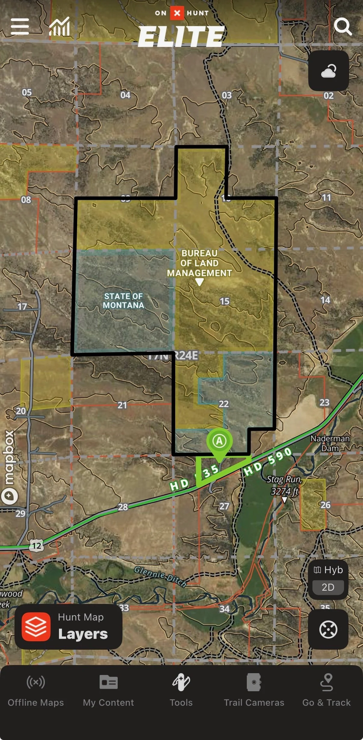
The Stanley Creek Project is the latest example of Eric’s passion and commitment to creating access to landlocked public lands. In cooperation with the Rocky Mountain Elk Foundation, along with state and federal agencies, the project aims to open access to 2,712 acres of landlocked public land to all in the near future. This is how it all came together:
After hearing about potential elk hunting in this area in the 2016/17 timeframe, Eric began browsing onX Hunt. At the time, the parcel data had an anomaly Eric believed was due to a power line utility easement, so no ownership was shown on a small path that led to 2,712 acres of landlocked public lands. Eric spoke with state and county officials and determined it was an error. There wasn’t a legal easement there to access the public land, and this temporarily ended his ambitions to hunt elk there.
In 2018, after noticing more and more access to public lands being lost, and establishing personal conservation and donation goals to help gain access to public lands, Eric began to eye the three properties that could unlock the 2,712 acres of public land he had previously researched. Initial attempts at acquisition were made with no success. and it fell off the radar. However, one of the three parcels was later sold off-market to an individual who purchased it for the premium elk hunting it provided. Eric was disappointed at another missed opportunity. However, in 2021, Eric connected with the right real estate agent in the area, who explained the new owner was willing to sell because of recent hunting regulation changes. After off-market negotiations and diligence over the next year, the deal was closed.
The RMEF team took it from there, coordinating site visits, mapping and taking on all the diligence and paperwork needed for Eric to transfer the property to a government entity. This is a tedious process that requires a team of dedicated and knowledgeable people. Thankfully, the RMEF has a talented team that devoted its time and effort to this project.
In the spring of 2025, RMEF coordinated and funded the removal of housing structures on the land and began planning for a trailhead with a goal to complete the land transfer to BLM later that year. Government changes created unexpected delays, but, thankfully, RMEF stepped up and offered to accept the donation of the land in 2025 and to finalize the transfer to the BLM.
These projects seem fairly simple on the surface, but they required a significant amount of time, effort and commitment from several talented individuals and organizations like the RMEF. Please consider a donation to RMEF so they can continue these great efforts.
To learn more about the RMEF and its efforts, click here.
To donate to the RMEF, click here.